The construction of a house is a big financial and time-consuming challgenge in life for the majority of private individuals.
The practical experience show that painstaking delays can be avoided by a good, careful planning and the involvement of professionals.
Without latest cadastre status - nothing will work
A basic requirement for the project is a suitable plot of land. Therefore, it is important to get confirmed by a preliminary inquiry at the competent planning authority, that the possibility of structural use of the chosen plot is given. Common grounds for refusal are:
For sure you already know as a well-informed private individual: Each plot change must be approved by the building authorities (municipality). Save time, avoid troubles. The construction permission plan with current official border points will be required to secure neighborhood rights and to fulfill the required minimum distances to neighbours.
With official documents from your Civil Engineer for Surveying (IKV) the owner transfers the legal responsibility to the IKV and avoids expensive court proceedings. The actual house planning can now be started.
Current-state-plan and optimal plot-usage
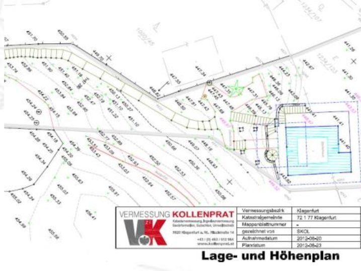
As a basis for the first plannings, related to the current location, an architect needs a current-state-survey of the existing environment.
The resulting current-state-plan contains all relevant topografic planning elements (relief heights, vegetation situation, building situations including ridge and eaves heights, nearby roads, sewer pipes, ..), and the current-state of the cadastre.

To identify and use favourable conditions for a construction site in a natural environment, examinations concerning the current lapescape (shadowing by mountains, houses, trees,..) at the corresponding location has to be done. With the help of in-house developed software astronomy programs the sun ecliptic is integrated into a locally taken panoramic photo. With this advanced planning basis the position and orientation of buildings and solar plants can be optimized.

The solar diagrams and sun cards allow exact day, month and year analyzes of the shade of the plot by the surrounding terrain. The diagrams and sun charts can be used for the purpose of energy use, building planning, regional planning and much more.
Building regulations - Prevent disputes
A prerequisite for the calculation of the border distance is the exact knowledge of the property boundaries. An Civil engineer consultant for surveying provides you with the necessary information.
In order to assess the minimum distance to the neighboring border (federal country specific), the planner must incorporate the height ratios of the site in his calculations.
Exactly information about the currently applicable spacing surface regulations you will learn here: www.bauordnung.at

If the plan designed by the architect corresponds with the ideas of the client - the surveyor transfers the project to the current-state plan. Possible building regulations violations are corrected after a thorough review of the current laws. Construction work can start now.
Reference Line control and height controls
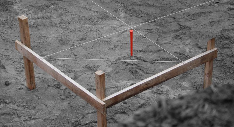
To make the necessary excavation for the basement efficiently, the stakeout of the excavation should be done.
The stakeout of the main corners ensures the rough location of the building. Furthermore, the volume of excavated material is determined.

Ask the Civil Engineer at the right time.
At the latest after completion of the base plate of the basement, it is strongly recommended and prescribed by law in many places to ask the Civil Engineer for his help. He certifies compliance with the location of the building relative to the property boundaries and compliance with municipal regulations of heights at the site. At this time it is still possible to apply small corrections. When the pit was dug wrong and the rising masonry is already constructed - the correction costs a lot of money and is also very time-consuming. The shunting of the house by hydraulic presses or deconstruction are then the only alternatives.


Surveying by Zivilgeometer creates safety- at the same time, the client has a certain proof in his hands that points were properly staked out handed over to the construction company.
Current-state-survey as a final dokumentation
Done - the house is built - Two things you should not forget yet.
- Report the planning authority that the submitted construction process is finished.
- Order a current-state-survey as a final dokumentation
With this plan of the Civil Engineer you have a legal protection that the house you have built coincides with the plans you sent the planning authority. Furthermore you have instant current and accurate planning documents. If you plan to modify something the architect can start immediately with this plans.